The map below depicts Stambourne in 1777 and was produced by John Chapman and Peter Andre
A few interesting points:
- Nortons is shown as Redgwell Norton as it used to be a “detached” part of Redgwell (Ridgewell).
- Stambourne Green has a higher prominence, where the green was and later used by Spurgeon for preaching.
- Pitifull Woods, although not named, is between Essex Farm and “Boveleys”.
- “A Meeting House” was later used by James and C.H. Spurgeon.
- The old Post Mill, destroyed in 1903 by a gale, is marked near Hill Farm.
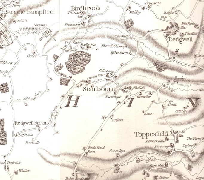
Stambourne map from 1777